

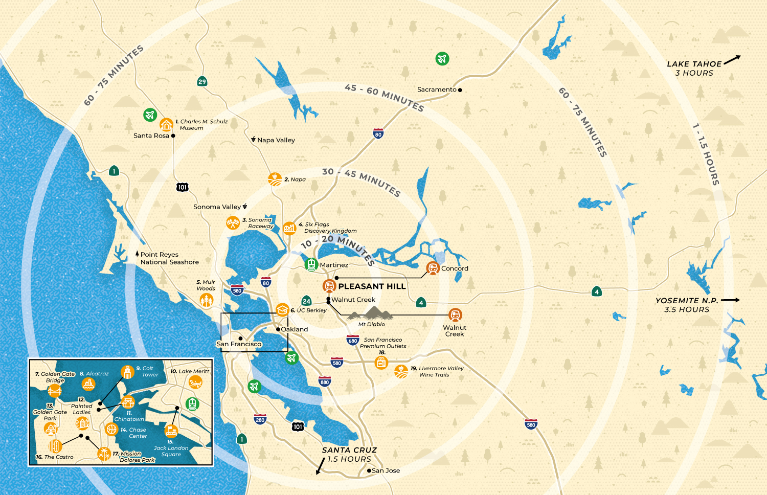
Tourist map of the San Francisco Bay Area for Pleasant Hill, California
Reference map for visitor guide
This practical map of the Bay Area was made the Pleasant Hill visitors guide. The idea of the map is to show how close Pleasant Hill is to many points of interest. I used concentric circles to indicate the driving times to the different attractions, landmarks and cities. Custom minimalist iconography was also created to clearly identify each point of interest.
- LocationPleasant Hill, San Francisco, California, USA
- Art DirectorDeanne O'Connor
- ClientStay Pleasant Hill
- CreditsThis 100% vector map was created by Greg Franco - Le Cartographiste with Adobe Illustrator and without the help of AI.
- Other maps for visitor guides• Illustrated Map of Wyoming • Illustrated map of Napa Valley • Illustrated map of Arlington, Texas • Illustrated map of the San Francisco Bay Area • Illustrated map of Ashtabula County • Illustrated map of Flint and Genesee County
- Want to see more?➟ Explore more practical maps here
