

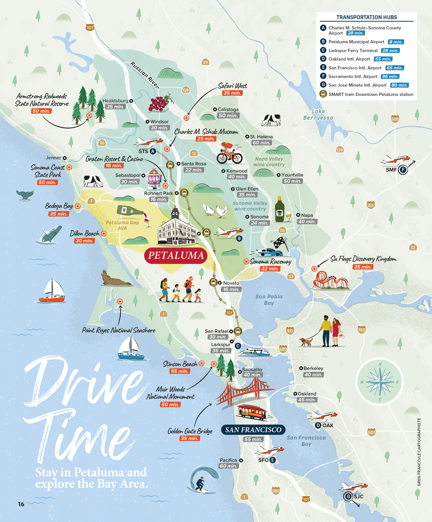
Illustrated map of the San Francisco Bay Area for Visit Petaluma
Tourist map for visitor guide
This illustrated map, created for the Visit Petaluma Visitors Guide, covers the broader San Francisco Bay Area and its surroundings. Its specific purpose is to show driving times from Petaluma to key points of interest, parks and airports in the region.
The map is drawn in the same hand-crafted style as the accompanying downtown Petaluma map, featuring illustrated landmarks, recreation areas, wildlife and activities throughout the area.
- LocationPetaluma, San Francisco, Bay Area, California, USA
- Art DirectorDeanne O'Connor for Wanderlust Content Studio
- ClientVisit Petaluma
- CreditsThis 100% vector map was created by Greg Franco - Le Cartographiste with Adobe Illustrator and without the help of AI. Adobe Illustrator brushes from RetroSupply Co.
- Related project• Petaluma Historic Downtown illustrated map
- Other maps for visitor guides• Illustrated Map of Wyoming • Illustrated map of Napa Valley • Illustrated map of Arlington, Texas • Illustrated map of Ashtabula County • Illustrated map of Flint and Genesee County
- Want to see more?➟ Explore more illustrated maps here
