
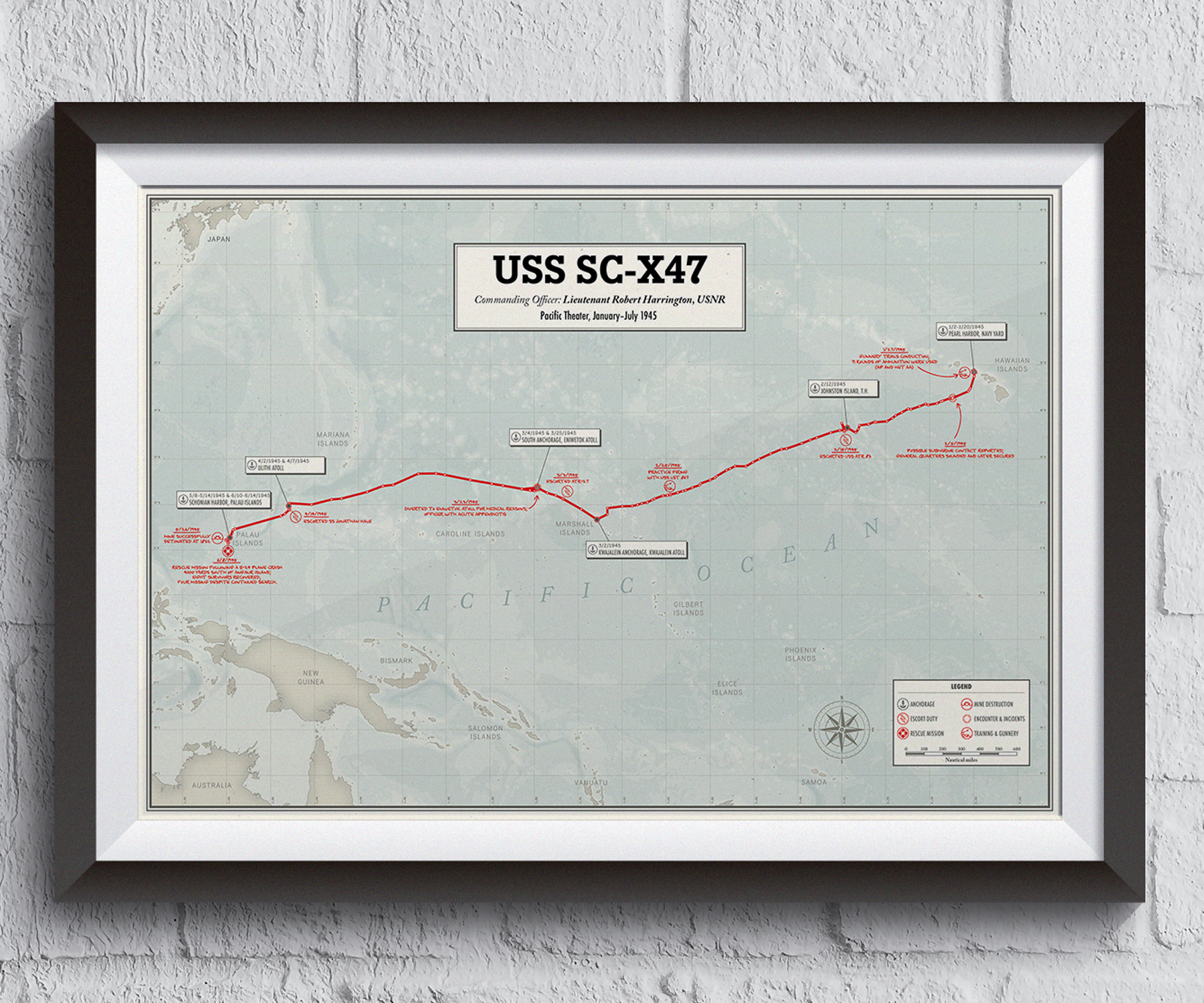


This custom map was commissioned as a personal commemorative piece based on a remarkable collection of wartime records.
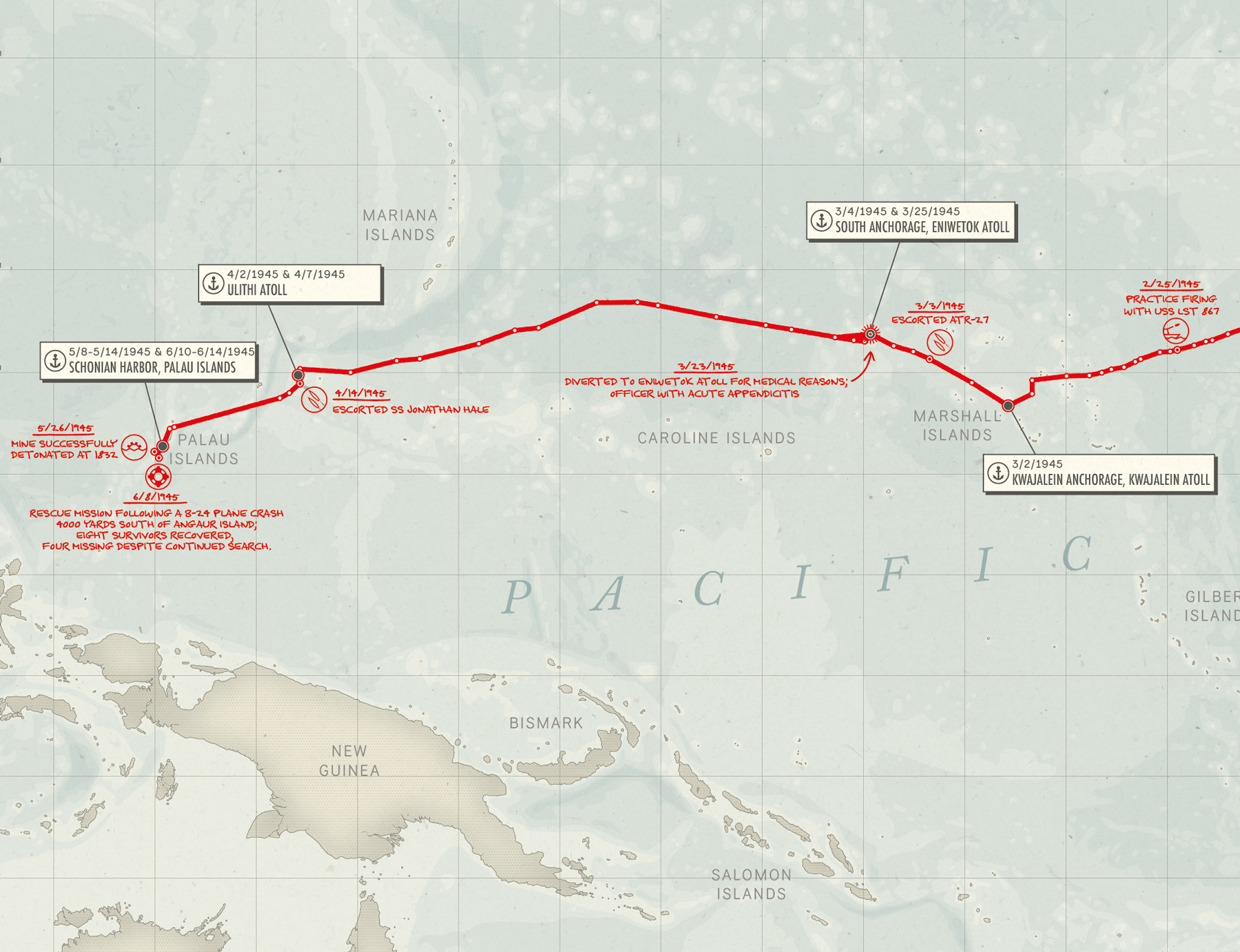
The client's grandfather served as commander of a submarine chaser operating in the Pacific during World War II. Through war diaries and deck logs preserved by the family, it was possible to recover a series of coordinates documenting the vessel's movements over a seven-month period.
Using these original records, I reconstructed the route of the vessel across the Pacific Ocean from Pearl Harbor (Hawaiian Islands) to Schonian Harbor (Palau Islands) and transformed this historical information into a large-format map designed for display. The final artwork traces the ship's exact course, highlights its anchorages and documents significant events recorded throughout the journey.
Inspired by the visual language of 1940s cartography, the map combines a vintage aesthetic with precise geographic information. Events such as mine destruction operations, escort duty, rescue missions, and training exercises are represented by a series of minimalist symbols and annotated directly on the map, echoing handwritten notes that might have appeared on historical naval charts.
Printed at 24 × 16 inches and professionally framed, the map was created as a unique keepsake celebrating both a family history and a chapter of World War II maritime history.
To preserve the privacy of the family, all names, dates and identifying details visible in the images displayed here have been modified.
