

Sailing the Seas Vol. 2 – Grand Maritime Adventures is a collaboration between gestalten and Sailing Collective Travel Co. and Dayyan Armstrong. This beautifully crafted book explores 21 sailing routes across some of the world's most breathtaking maritime destinations.
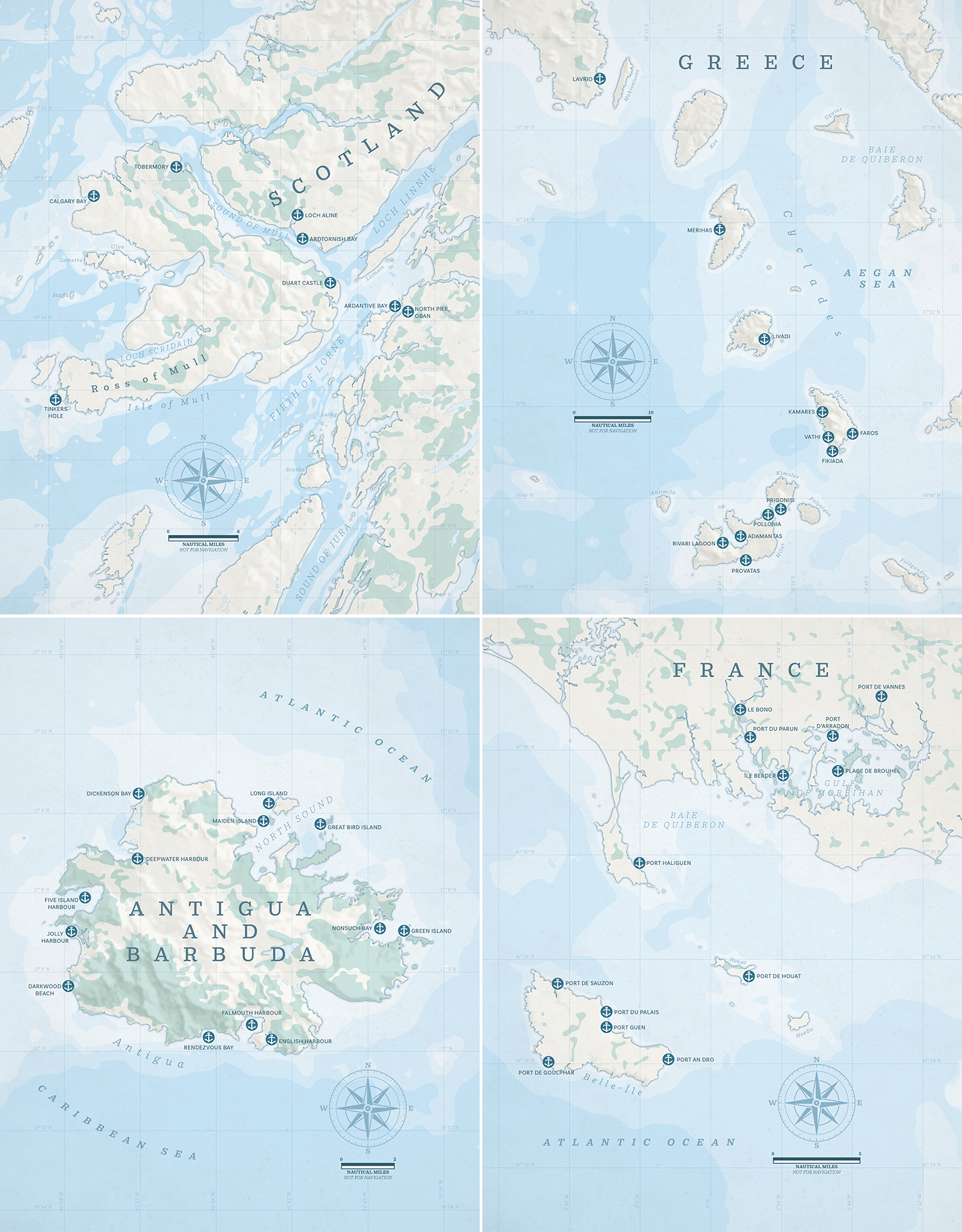
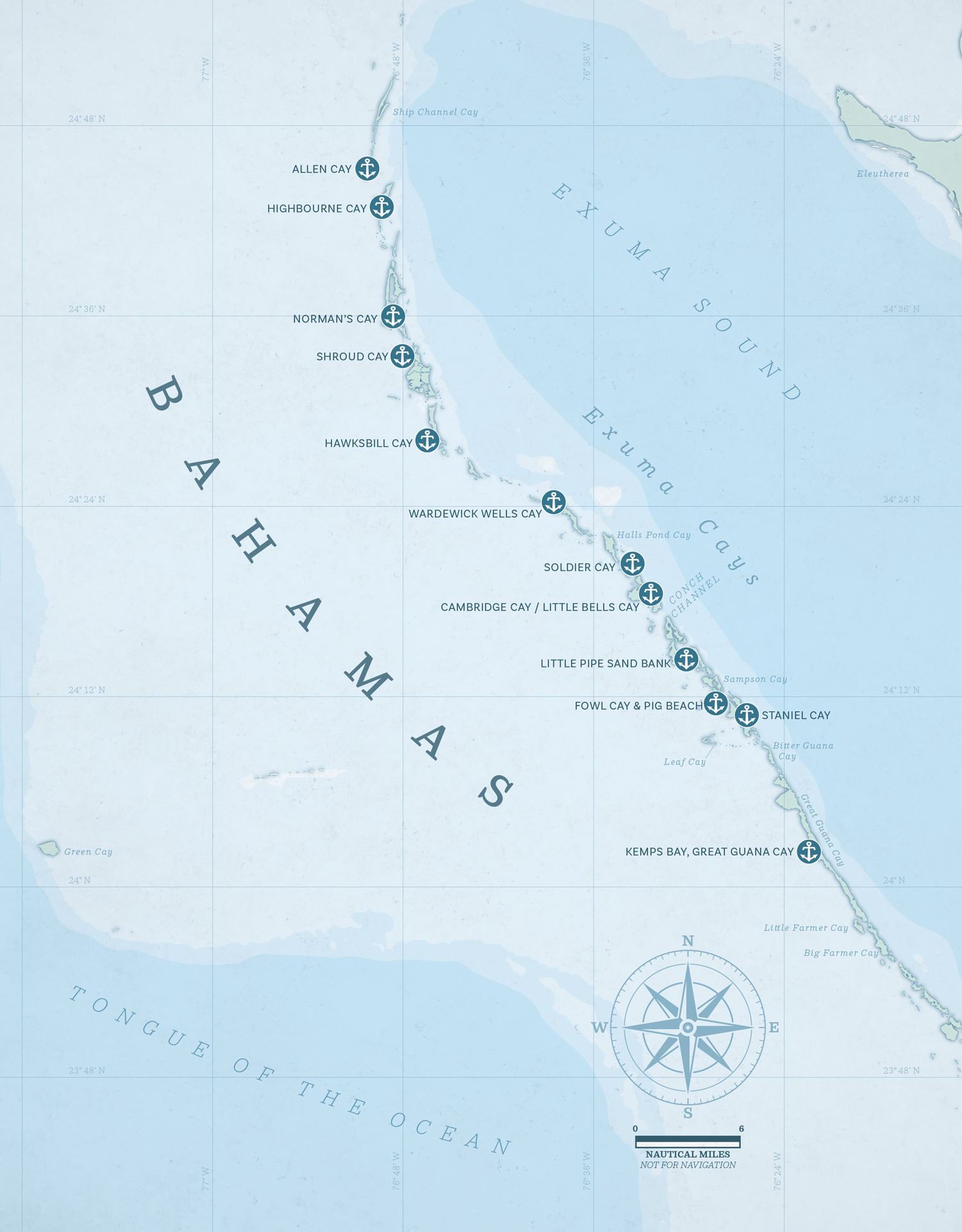
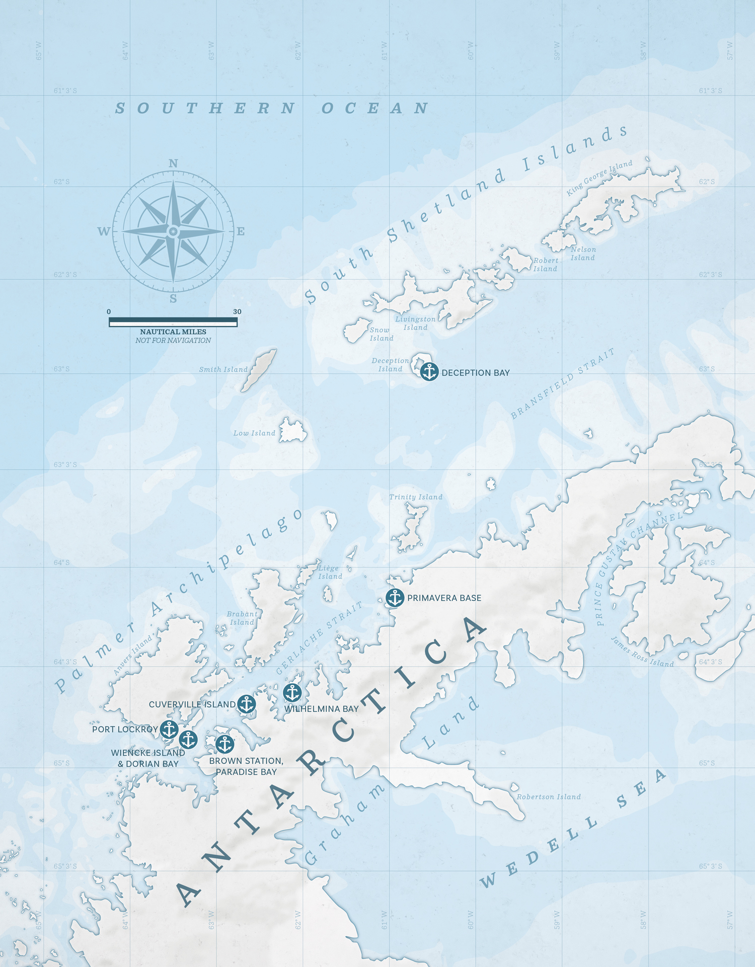
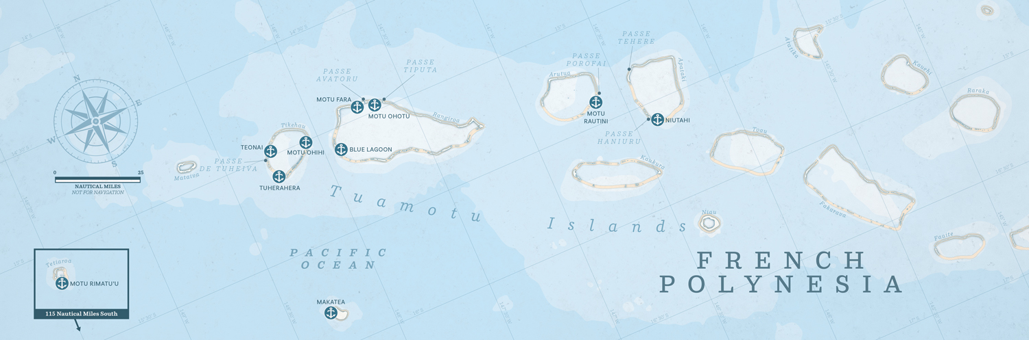
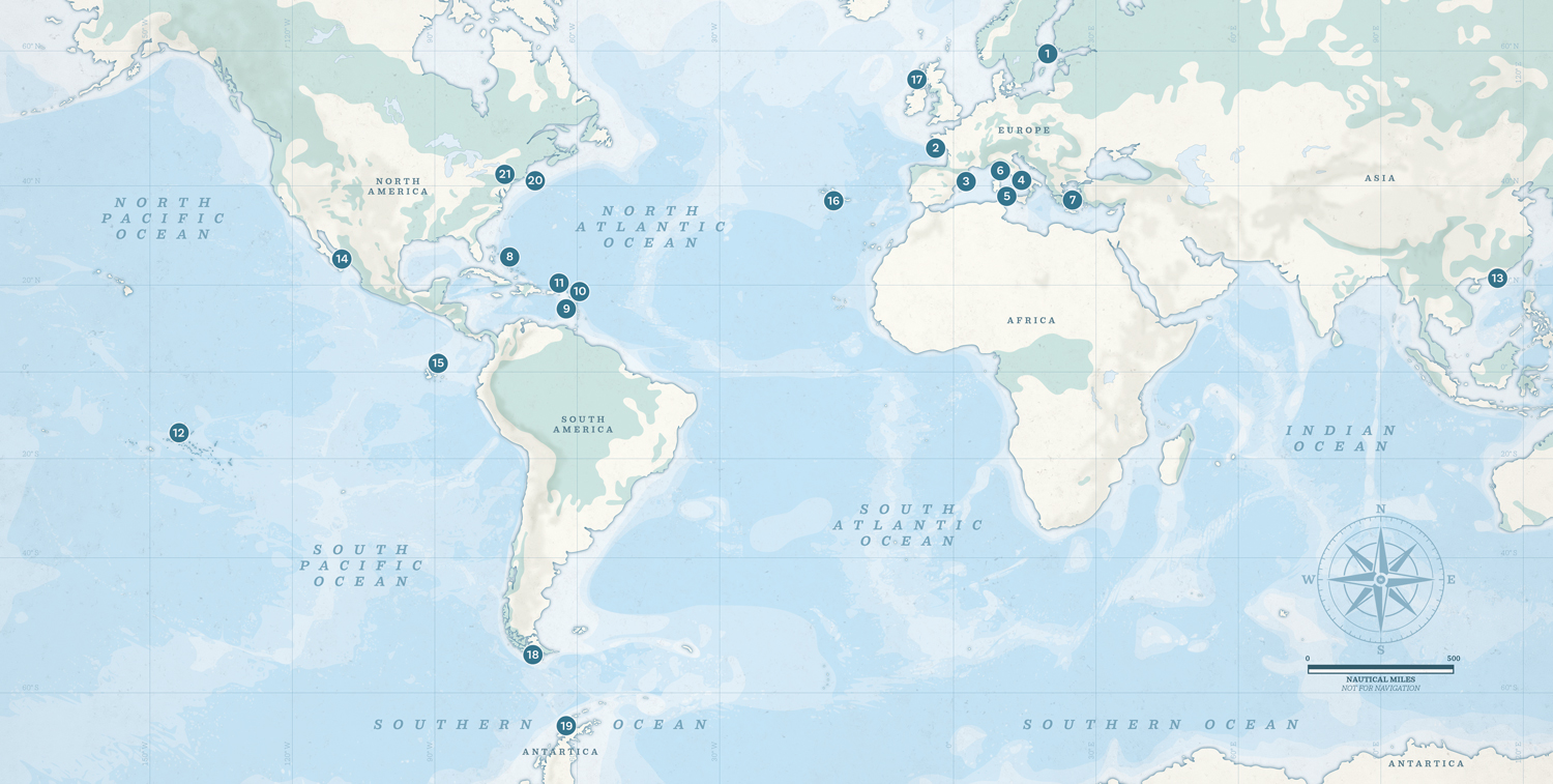
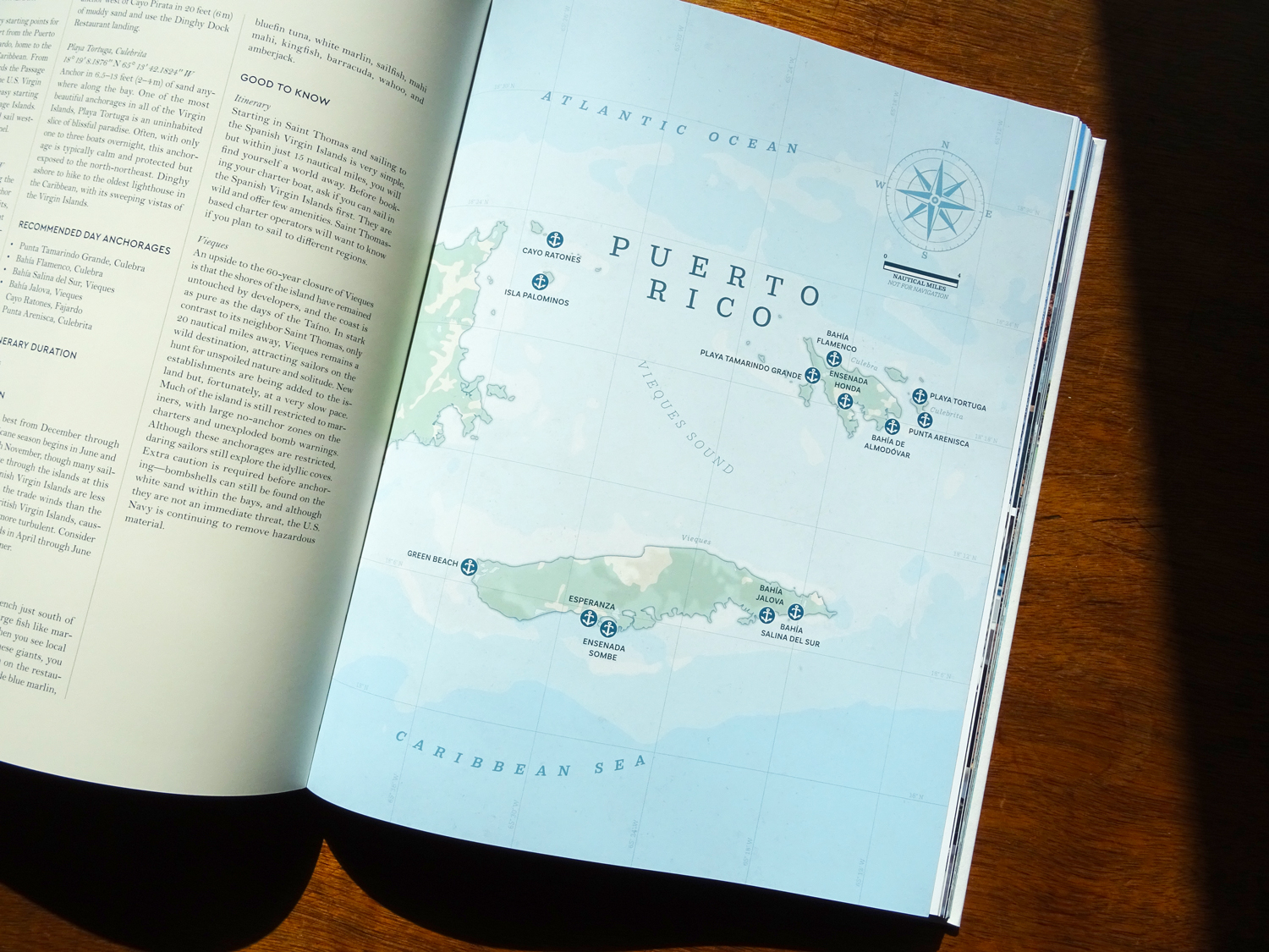
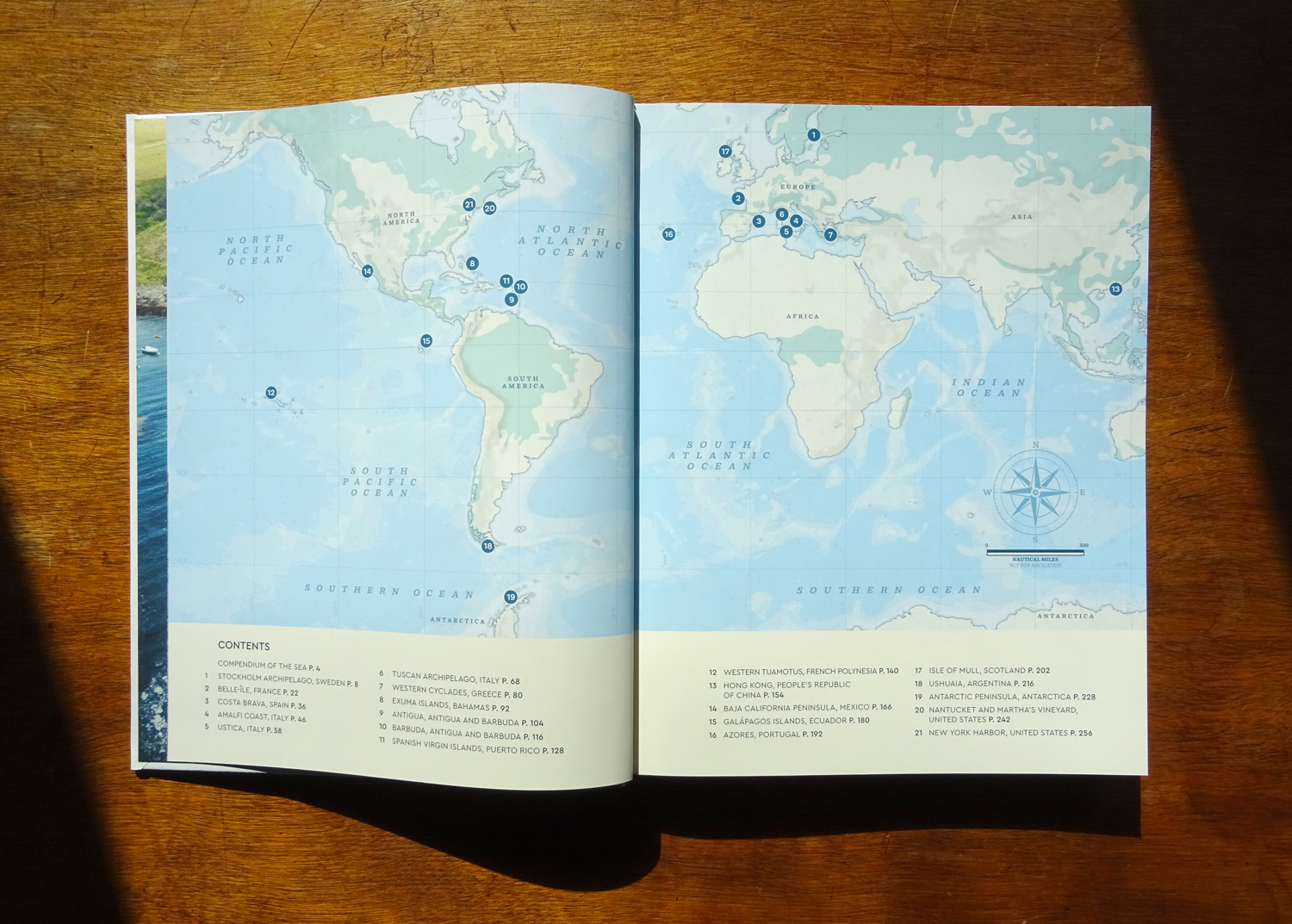
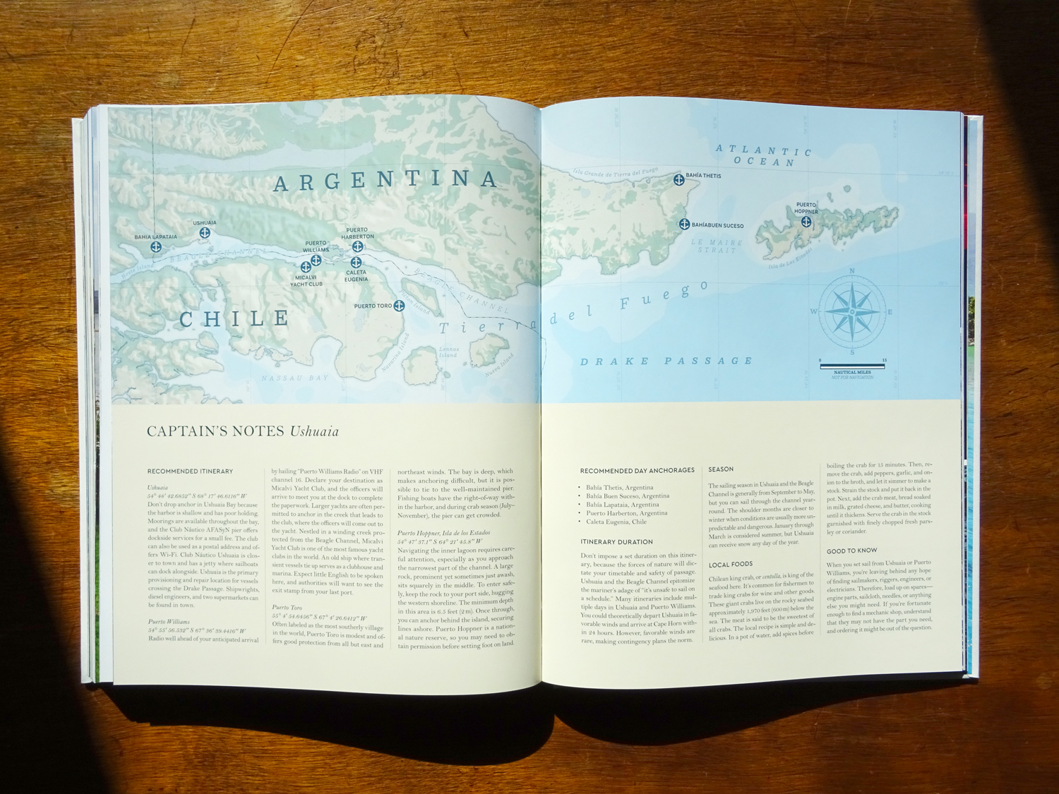
I designed 22 nautical-inspired maps, each showcasing a different sailing journey. These maps highlight key maritime elements, including bathymetry (underwater topography), hillshading for land relief, latitude and longitude lines, a scale in nautical miles, and recommended anchorages in bays and around islands.
One of the most exciting aspects of this project was mapping such a diverse range of locations, from the icy waters of Antarctica to the turquoise lagoons of French Polynesia, from the rugged coasts of Scotland to the sun-drenched shores of the Bahamas. Each map captures the unique geography of its region while maintaining a cohesive visual style inspired by classic nautical charts.
IMPORTANT NOTE: THESE MAPS SHOULD NOT BE USED FOR NAVIGATION
