Illustrated map of Ashtabula County and the Grand River Valley AVA
Travel
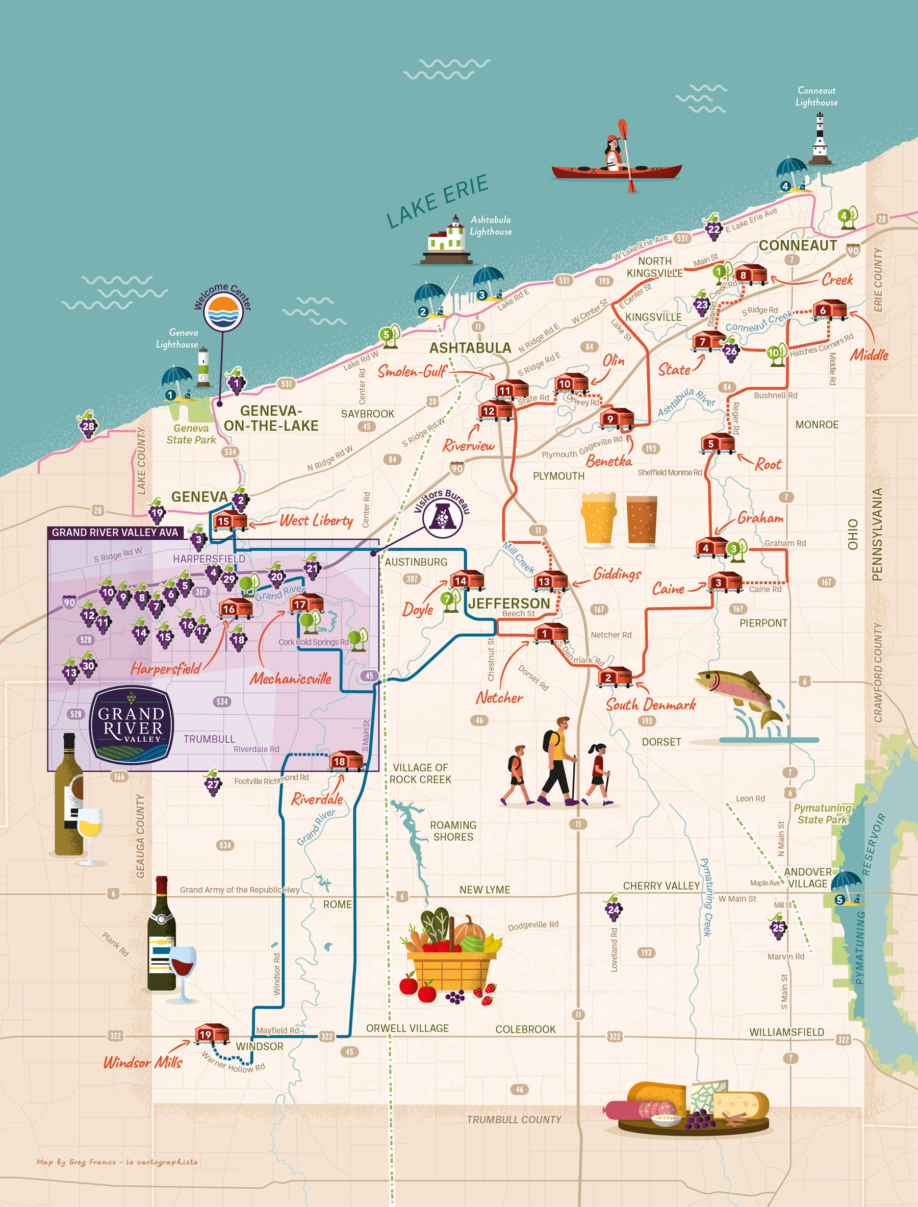
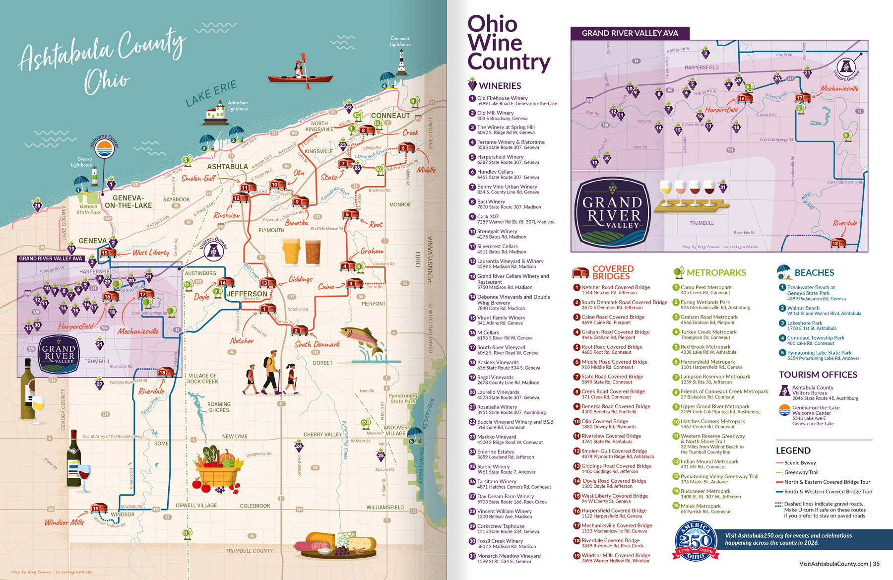
This illustrated map depicts Ashtabula County and the Grand River Valley AVA, located along the shores of Lake Erie in Ohio. The region is widely known as Ohio Wine Country, with more than 30 wineries, and for its 19 covered bridges, the largest collection in the state, including structures dating back to the mid-1800s.
The map was created for the 2026 Ohio Wine Country Visitors Guide. It spans a full spread, with the map of Ashtabula County on one page and a zoomed-in inset of the Grand River Valley on the opposite page to ensure greater clarity and readability.
The map features 75 points of interest organized into six categories: wineries, covered bridges, metro parks, beaches, tourism offices, and lighthouses. A scenic byway, two covered bridge driving tours, and a walking trail are also highlighted. Roads surrounding each point of interest and itinerary are labeled, along with townships across the county.
Given the high number of featured locations, maximizing legibility was essential. Each category is represented by a dedicated icon, and all points of interest are numbered for easy reference.
Illustrated elements were also created to convey the atmosphere of the region, highlighting outdoor activities such as kayaking, walking, and fishing, as well as winemaking and the local food scene.
LocationAshtabula County, Geneva-On-The-Lake, Conneaut, Jefferson, Lake Erie, Ohio, USA