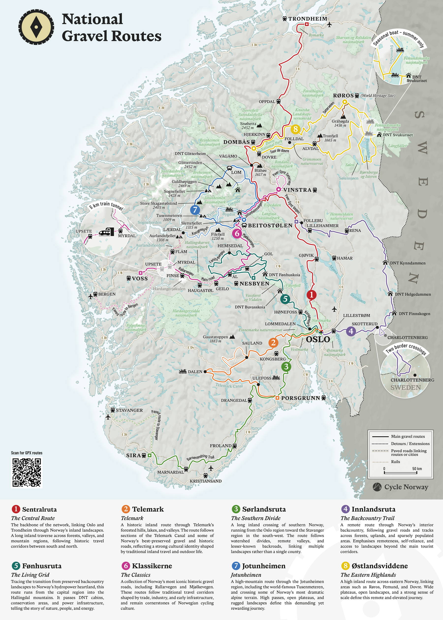
Map of Norway highlighting the National Gravel Routes
Editorial
This map of Norway was created to highlight the National Gravel Routes, a network of eight long-distance gravel cycling routes connecting some of the country’s most remarkable landscapes. The project is an initiative by Matthew Tolley from Cycle Norway.
Using a traditional cartographic approach, the map provides a realistic representation of the coastline from Oslo to Trondheim. It shows terrain, glaciers, national parks, and protected areas in relation to the routes, offering both geographic context and practical information for riders.
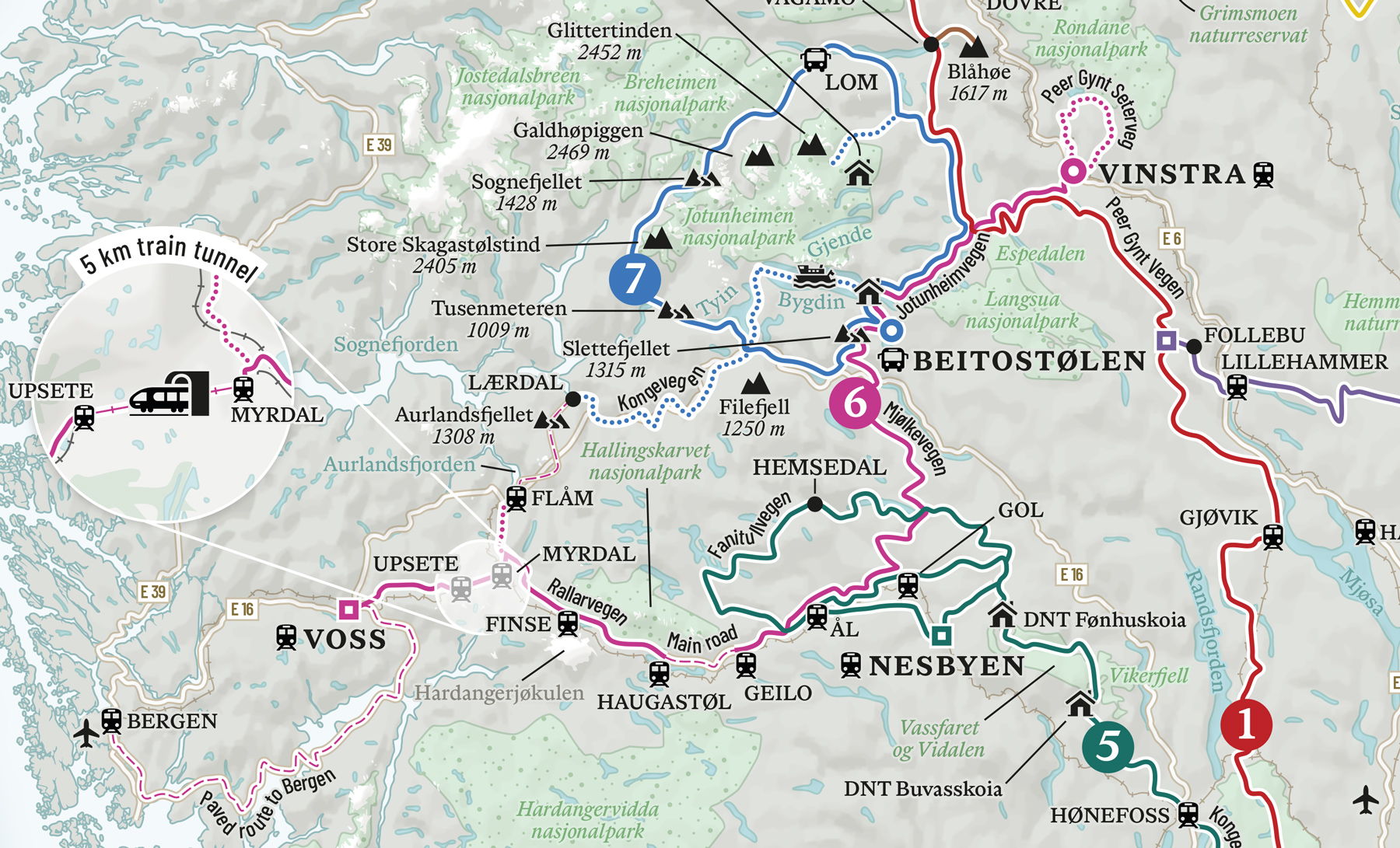
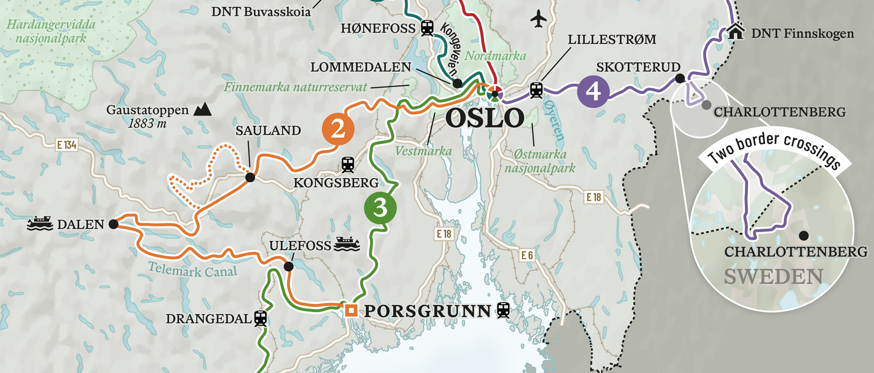
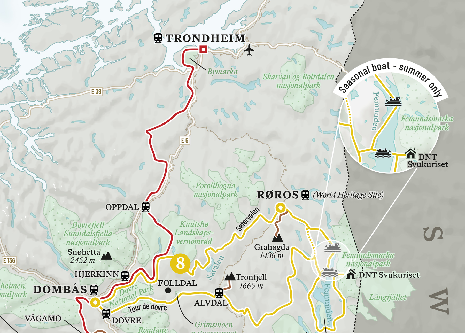
The base map uses neutral tones in light greys and greens, while more vibrant colors are used to distinguish each of the eight routes. Key points of interest along the routes are labeled, and simple icons indicate transport connections such as train and bus stations, airports, ferry crossings, and mountain passes.
I created zoomed-in insets for specific sections of the routes where additional detail is required, including border crossings, train tunnels, and seasonal ferry routes.
The map was designed to be used across multiple platforms, with adaptations created for print, digital, and social media. A poster version was also developed, including a legend describing each route.
CreditsThese 100% vector maps were created by Greg Franco - Le Cartographiste with Adobe Illustrator and without the help of AI.
Map data from OpenStreetMap