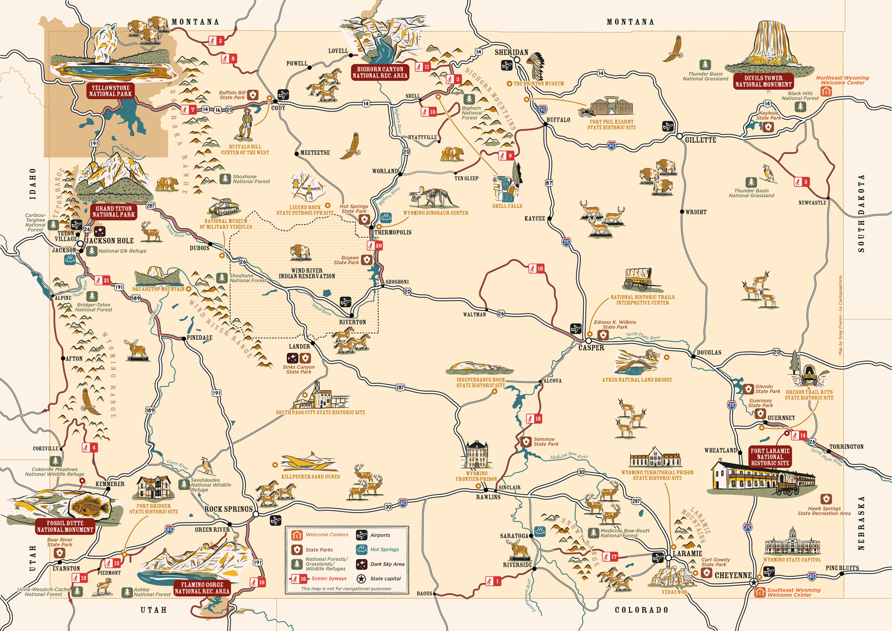
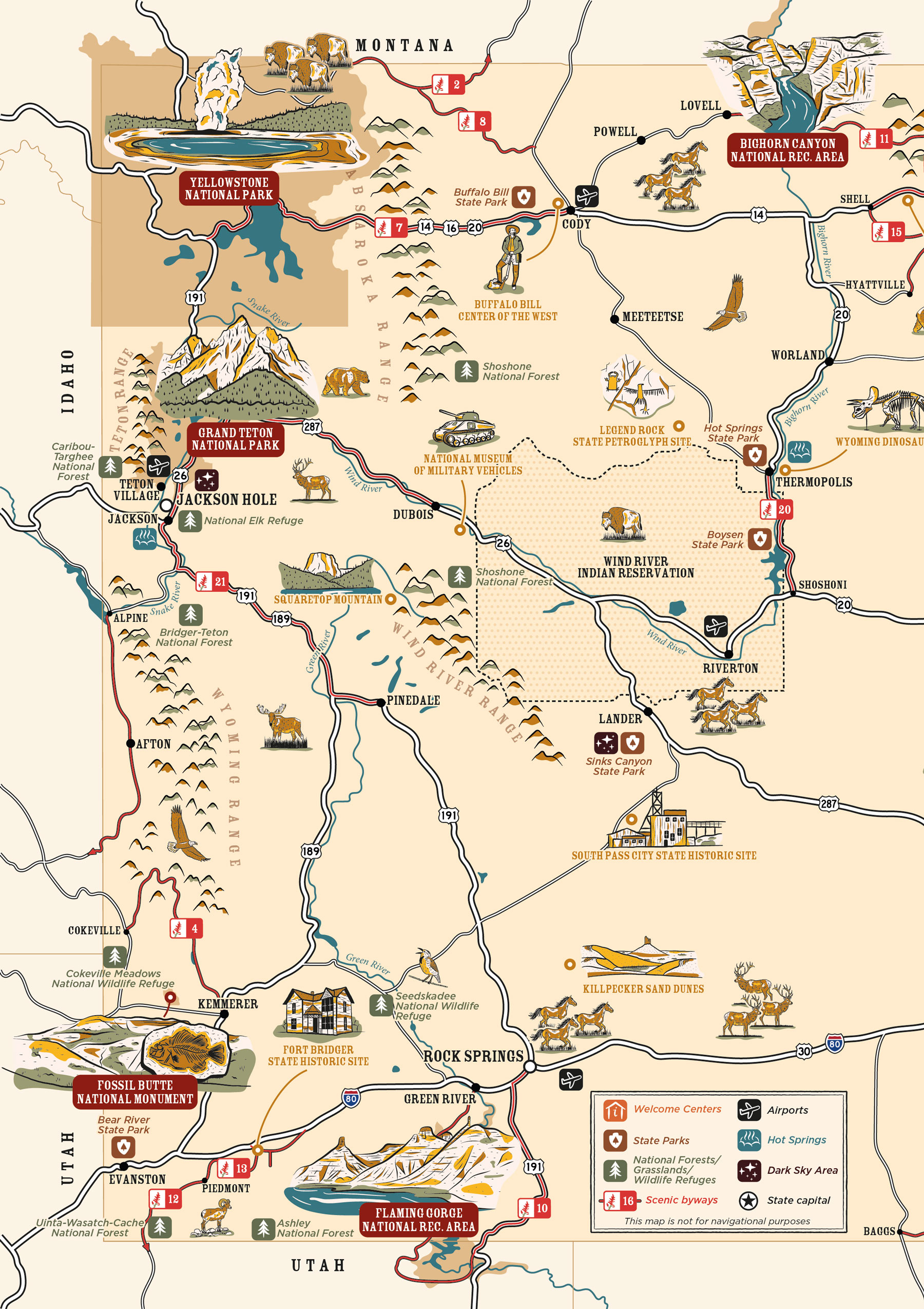
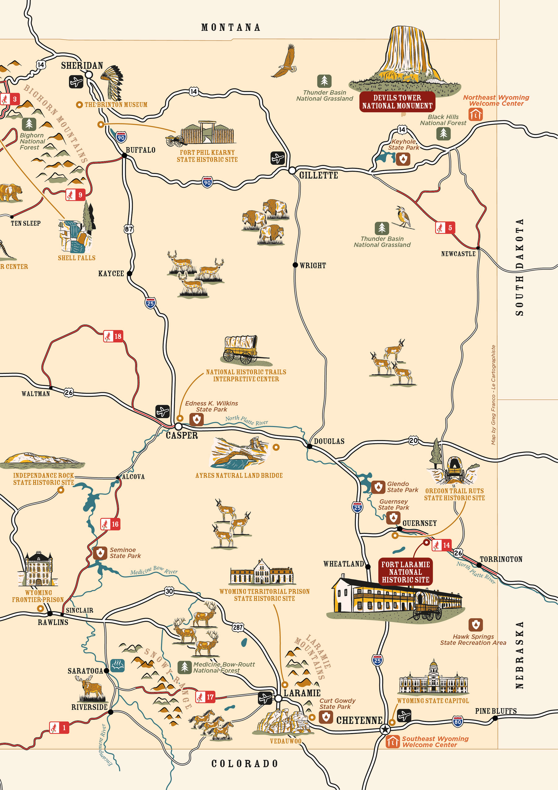


This illustrated map was created for the 2026 official Travel Wyoming Visitor Guide, where it spans a full double-page spread.
Designed as both a practical and engaging tourist map, it highlights key attractions across the state while clearly locating welcome centers, state parks, national forests, grasslands, wildlife refuges, airports, hot springs, dark sky areas, and scenic byways. The map also features Wyoming’s main roads, rivers, mountain ranges, and the Wind River Indian Reservation.
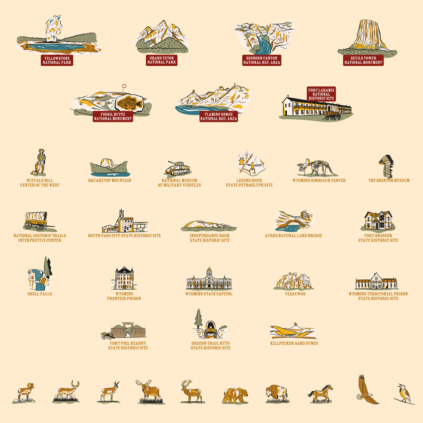
I created 36 custom illustrations to bring the territory to life, representing iconic destinations such as Yellowstone National Park and Grand Teton National Park, Bighorn Canyon and Flaming Gorge National Recreation Areas, Fossil Butte National Monument, Fort Laramie National Historic Site, as well as museums, natural landmarks, and local wildlife including bighorn sheep, elk, grizzly bears, bison, and hawks.
To ensure visual consistency with the guide’s existing graphics, I developed a series of hand-drawn illustrations and custom icons using a limited color palette. Creative shadows and highlights add depth while maintaining a cohesive, recognizable identity across the spread.
Working on this project was a real pleasure! Wyoming’s vast landscapes, wilderness, and heritage make it an inspiring subject for illustrated cartography.
