

Illustrated campground map
Hand-drawn site plan
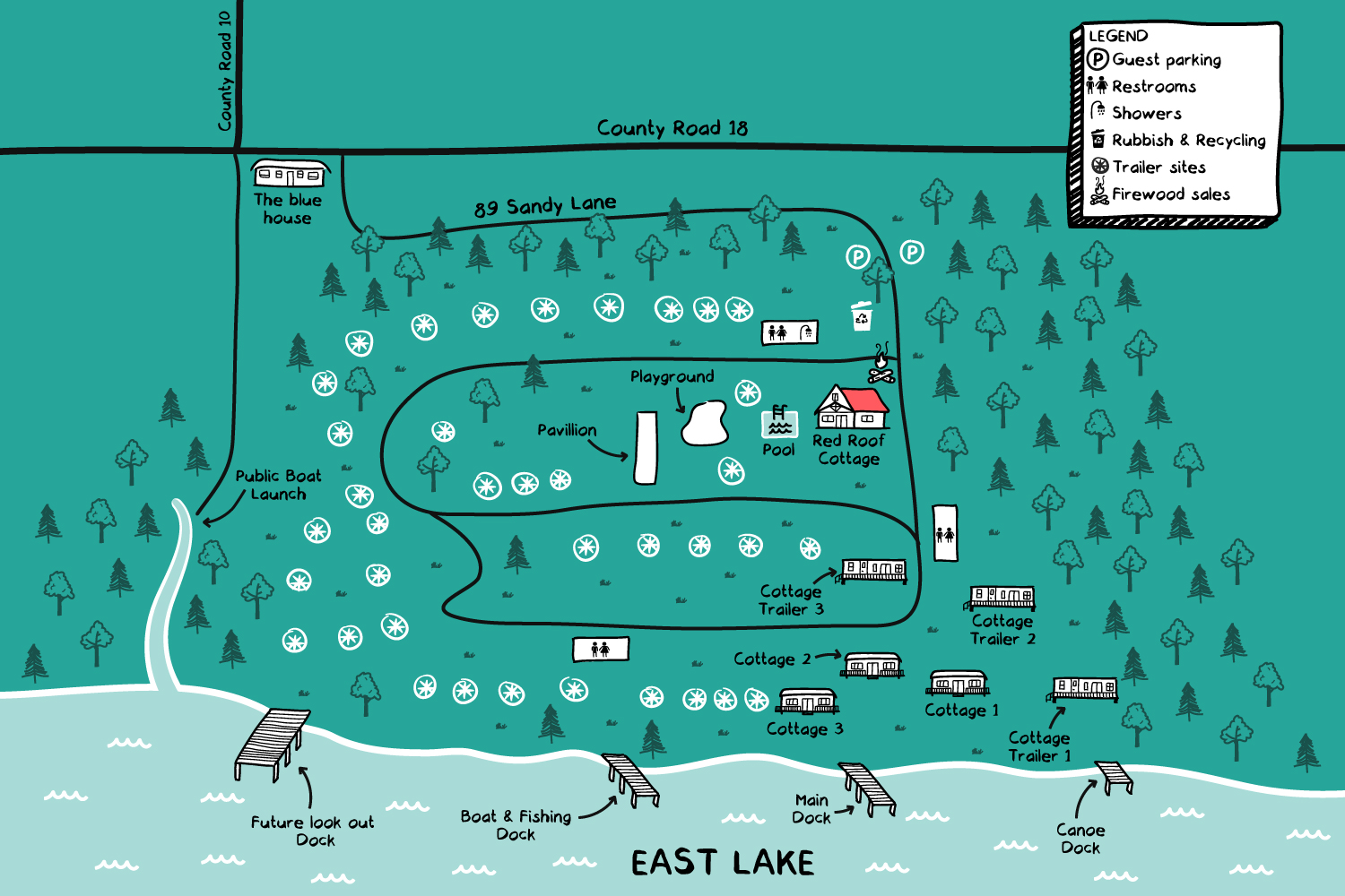
Hand-drawn illustrated site map of an RV park and cottage resort on the shores of a lake in Cherry Valley, Ontario, Canada. The map gives guests a clear picture of the property's layout (cottages, RV pitches, facilities and waterfront areas) in a warm, hand-crafted style that reflects the nature of the site.
- LocationCherry Valley, Ontario, Canada
- CreditsThis 100% vector map was created by Greg Franco - Le Cartographiste with Adobe Illustrator and without the help of AI. Adobe Illustrator brushes from RetroSupply Co.
- Want to see more?➟ Explore more illustrated maps here
