

Illustrated map of civil engineering structures in France for Le Minorange magazine
Editorial
This illustrated map was created for Le Minorange, the internal magazine of Groupe Bouygues. Published twice a year since 1963, the magazine was created by the Group's founder Francis Bouygues to inform employees about the Group’s strategy and the activities of its different subsidiaries.
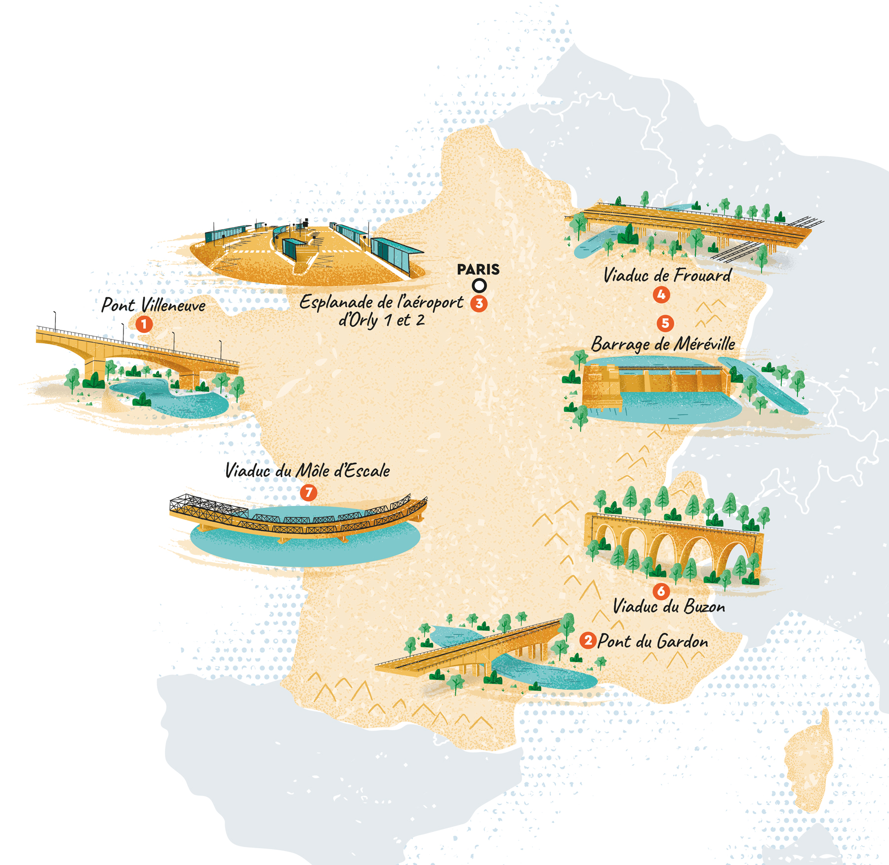
The map accompanies a special feature highlighting several civil engineering structures renovated by the Group across France.
Seven projects are represented through custom illustrations, including bridges, car parks and a dam. Each structure is illustrated and placed on the map to help readers locate where these renovation works took place.
Civil engineering projects often involve large concrete infrastructures that can be difficult to represent visually. To bring energy and personality to the page, the map uses bold colors and playful illustrations, turning these technical structures into engaging visual elements while keeping the geographic information clear.
- LocationFrance
- ClientGroupe Bouygues
- Art DirectionAnne-Cécile Manfré for Sequoia
- CreditsThis 100% vector illustrated map was created by Greg Franco - Le Cartographiste with Adobe Illustrator and without the help of AI.
